arXiv:2404.05913v1 Announce Type: new Abstract: Background: Clinical diagnosis is typically reached by following a series of steps recommended by guidelines authored by colleges of experts. Accordingly, guidelines play a crucial role in rationalizing clinical decisions but suffer from limitations as they are built to cover the majority of the population and fail at covering patients with uncommon conditions. Moreover, their updates are long and expensive, making them unsuitable for emerging diseases and practices. Methods: Inspired by guidelines, we formulate the task of diagnosis as a sequential decision-making problem and study the use of Deep Reinforcement Learning (DRL) algorithms to learn the optimal sequence of actions to perform in order to obtain a correct diagnosis from Electronic Health Records (EHRs). We apply DRL on synthetic, but realistic EHRs and develop two clinical use cases: Anemia diagnosis, where the decision pathways follow the schema of a decision tree; and Systemic Lupus Erythematosus (SLE) diagnosis, which follows a weighted criteria score. We particularly evaluate the robustness of our approaches to noisy and missing data since these frequently occur in EHRs. Results: In both use cases, and in the presence of imperfect data, our best DRL algorithms exhibit competitive performance when compared to the traditional classifiers, with the added advantage that they enable the progressive generation of a pathway to the suggested diagnosis which can both guide and explain the decision-making process. Conclusion: DRL offers the opportunity to learn personalized decision pathways to diagnosis. We illustrate with our two use cases their advantages: they generate step-by-step pathways that are self-explanatory; and their correctness is competitive when compared to state-of-the-art approaches.
[This article was first published on R Code – Geekcologist, and kindly contributed to R-bloggers]. (You can report issue about the content on this page here)
Want to share your content on R-bloggers? click here if you have a blog, or here if you don’t.
As an ecologist, being able to easily visualize biodiversity occurrence data is an essential need as this kind of data visualization provides critical insights into species distribution patterns and ecological requirements, which is essential for understanding biodiversity dynamics in space and time. Moreover, for pragmatic reasons, fast and simple biodiversity data visualization can help us to define sampling and monitoring strategies in the field, optimizing resource and time allocation. As someone who is a passionate enthusiast for wildlife and nature, being able to visualize species occurrence is also particularly important when I am planning a trip to a new place I have never been, or just “virtually exploring” a far and unknown corner of the planet.
This simple R Shiny app allows users to explore species distributions by selecting a taxonomic group and defining a geographic area of interest using latitude and longitude coordinates to define a polygon (only min and max latitude and longitude are used to define the polygon, thus complex boundaries can not be included here), which will be used to retrieve species occurrence data from GBIF within this quadrilateral. The data will be displayed on an interactive map using the R package leaflet.
In the source code, you can also change the taxa of interest to be shown in the user interface and the months of the year in which the data was collected, which might be useful for seasonal species.
The user interface should look like this:
Here is the R code!
# Install packages
install.packages(c("shiny", "rgbif", "leaflet", dependencies=T))

# Load packages
require(shiny)
require(rgbif)
require(leaflet)

# Define function to search for occurrences of  specified clades within a polygon (i.e, bounding box=bbox)
search_occurrences <- function(bbox, clade) {
  occ_search_result <- occ_search(
    geometry = paste("POLYGON((", bbox["min_longitude"], " ", bbox["min_latitude"], ",",
                     bbox["min_longitude"], " ", bbox["max_latitude"], ",",
                     bbox["max_longitude"], " ", bbox["max_latitude"], ",",
                     bbox["max_longitude"], " ", bbox["min_latitude"], ",",
                     bbox["min_longitude"], " ", bbox["min_latitude"], "))"),
    month = 1, 12,###define months of the year
    scientificName = clade,
    hasCoordinate = TRUE
  )
  return(occ_search_result)
}

# Define user interface
ui <- fluidPage(
  titlePanel("Species Occurrence"),
  sidebarLayout(
    sidebarPanel(
      selectInput("clade", "Choose a clade:",
                  choices = c("Aves", "Coleoptera", "Amphibia", "Plantae", "Mammalia", "Actinopterygii", "Insecta"),#you can change the default clades according to your taste in biodiversity
                  selected = "Aves"), #first clade to be shown in the drop down box
      numericInput("min_longitude", "Minimum Longitude:", value = -9),##by default you will have the approximate borders of portugal, but this can be changed in the user interface or directly here
      numericInput("max_longitude", "Maximum Longitude:", value = -6),
      numericInput("min_latitude", "Minimum Latitude:", value = 36),
      numericInput("max_latitude", "Maximum Latitude:", value = 42)
    ),
    mainPanel(
      leafletOutput("map")
    )
  )
)

# Define server logic
server <- function(input, output) {
  # Render the leaflet map based on user's clade selection and polygon coordinates
  output$map <- renderLeaflet({
    clade <- input$clade
    bbox <- c(
      min_longitude = input$min_longitude,
      min_latitude = input$min_latitude,
      max_longitude = input$max_longitude,
      max_latitude = input$max_latitude
    )

    occ_search_result <- search_occurrences(bbox, clade)

    leaflet() %>%
      addTiles() %>%
      addCircleMarkers(
        data = occ_search_result$data,
        lng = ~decimalLongitude,
        lat = ~decimalLatitude,
        popup = ~species,
        radius = 5,
        color = "blue",
        fillOpacity = 0.7
      ) %>%
      setView(
        lng = mean(bbox[c("min_longitude", "max_longitude")]),
        lat = mean(bbox[c("min_latitude", "max_latitude")]),
        zoom = 14
      )
  })
}

#et voilà! You can run the application
shinyApp(ui = ui, server = server)
To leave a comment for the author, please follow the link and comment on their blog: R Code – Geekcologist.
Implications and Future Developments of Biodiversity Occurrence Visualization Using GBIF and R Shiny
The use of the Global Biodiversity Information Facility (GBIF) and R Shiny for biodiversity occurrence data visualization is a vital tool in understanding species distribution patterns and ecological requirements. The insights this kind of data visualization offers are critical for understanding biodiversity dynamics both in space and time. Furthermore, such visualization is extremely useful in strategic planning of sampling and monitoring activities in the field, through optimized resource and time allocation.
Long-term Implications
Implementing R Shiny apps to collect data from GBIF can have broad, long-term implications for ecological research and conservation. Being able to easily access and visualize over 2 billion records of species occurrence globally helps scientists monitor species distributions over space and time. This can be critical in detecting biodiversity changes due to climate change, habitat destruction, or invasive species. The app can be particularly useful for conservation ecologists who are planning fieldwork in new or remote areas, as it can help decide the best areas to sample based on known species occurrences.
Potential Future Developments
While the current system is already beneficial, there is room for significant improvements in the future. Here are a few potential developments:
Expanding the polygon specifications: Currently, this app only uses minimum and maximum latitude and longitude to define a polygon, restricting its use to a quadrilateral. In the future, more complex polygons could be used to better restrict searches to the actual area of interest.
Including more filtering options: Being able to filter the data by additional parameters, such as date, would be useful. This could allow for more specific temporal analyses, such as species migration tracking.
Enhancing the data presentation: Currently, the app displays the data in an interactive map with basic information. More detailed results, that possibly include the introduction of graphs or charts for data visualization, could be beneficial for complex analyses.
Actionable Advice
Overall, using this R Shiny app for accessing GBIF data offers a great opportunity for researchers and biodiversity enthusiasts to visualize global biodiversity occurrence data. To make the most of this app, users should:
Ensure they have a good understanding of R programming to customize the data retrieval and visualization to better suit their specific needs.
Regularly keep the app updated with the latest data from GBIF to have the most recent information available for any analysis.
Consider the potential future developments and how they might be implemented into the application to enhance usability and precision.
Recent developments in building large language models (LLMs) to boost generative AI in local languages have caught everyone’s attention. This post focuses on the needs and challenges of homegrown LLMs amid the fast-evolving technology landscape.
Introduction
The rapidly developing field of large language models (LLMs) has sparked widespread interest, particularly due to its potential to enhance generative artificial intelligence (AI) in local languages. This follow-up piece discusses the long-term implications these developments may hold, potential future progress, and what these insightful revelations could mean for businesses and developers currently immersed in this exciting technological landscape.
The Potential of Homegrown Large Language Models
One of the key points raised is the significant potential of LLMs in boosting AI’s ability in local languages. This has led to a surge in demand for homegrown LLMs, as technological advancements create space for unprecedented linguistic inclusivity. This could mean vastly improved user experiences as AI extends to cater to non-global languages, fostering diversity and inclusiveness while reducing language barriers.
Implications and Future Developments
Going forward, the advent of homegrown LLMs might trigger a linguistic revolution in the technological sphere. As more local languages are accommodated by AI, the technologies could become increasingly accepted and adopted globally, breaking down geographical boundaries and enabling harmonious intercultural interactions.
Expansive developments in AI functionality might also result in a broader range of applications beyond what we currently envision. For instance, we could see AI revolutionizing educational technology by providing nuanced linguistic training, or enhancing health communication by enabling sophisticated interactions between healthcare providers and people from diverse linguistic backgrounds.
Actionable Advice for Stakeholders
On basis of these insights, here are some actionable steps that stakeholders can take:
Investment: Entrepreneurs and companies should consider investing in the development of LLMs for local languages as they have vast potential for growth and can be a source of competitive advantage.
Partnerships: Organizations could form partnerships with language experts and linguists, optimizing the accuracy and cultural sensitivity of the developed language models.
Anticipate regulations: With enhanced language capabilities, new privacy and ethical concerns could arise. Organizations should anticipate potential regulatory changes and prepare to address them.
Conclusion
In conclusion, the rise of LLMs for local languages represents an exciting frontier in AI. This development invites businesses and developers to participate in creating an inclusive digital future, while also bringing its own set of challenges. Careful and considered advancement in this field could reshape the global digital landscape, creating space for languages and cultures previously overlooked in technology.
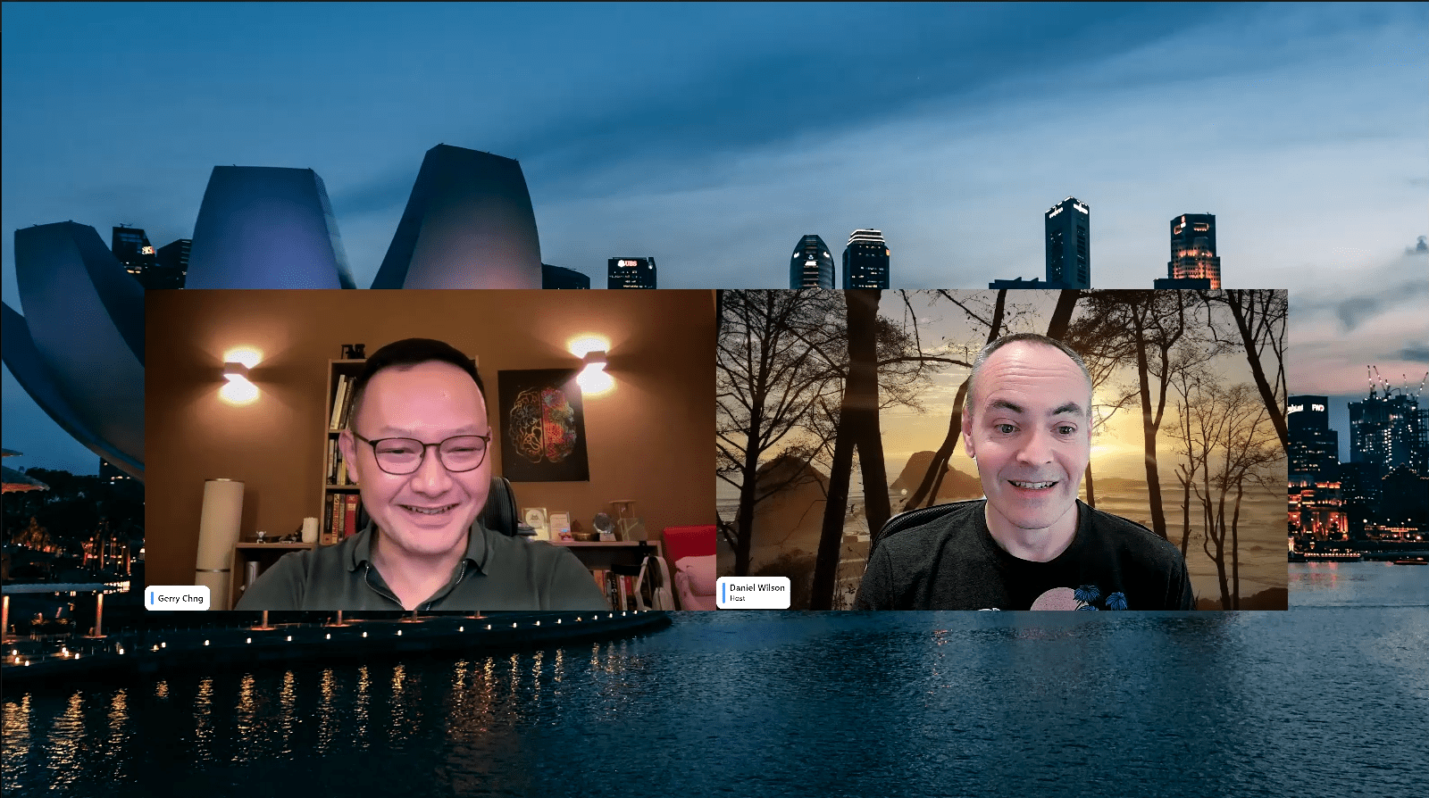
Dan Wilson and Gerry Chng have a roundtable discussion on AI policies, practices, and safety measures surrounding this emerging technology.
The Future of AI: Policies, Practices, and Safety Measures
The dynamism of artificial intelligence (AI) is unprecedented and it continues to evolve with significant potential for transformation. Dan Wilson and Gerry Chng’s in-depth discussion on AI policies, practices, and safety measures acts as a robust reminder of the opportunities and challenges embedded in this technological frontier. Their insights have long-term implications and substantial potential in paving the path for future developments.
Long-term Implications and Future Developments
The discourse between Wilson and Chng shed light on multiple factors that will invariably influence the long-term consequences of AI. They include regulatory and policy constraints, ethical considerations, data privacy, and the development of safe AI practices. Engaging with these factors with a foresightful approach opens dialogue for future developments.
Regulatory Policies and Ethical Concerns
A key concern associated with AI is the development and enforcement of appropriate regulatory policies. These policies have a significant impact on the long-term consequences of AI implementation. Ethical implications, another significant facet of AI progress, are intricately linked with the implementation of these policies. Unchecked AI advancement can risk unwanted societal consequences, underscoring the need for regulatory policies that factor in ethical considerations.
Data Privacy
With increasing dependence on AI, data privacy is another area that warrants attention. Protection of user data needs to be embedded into the fabric of AI development, facilitating trust-building in technology. As AI integration increases, a comprehensive policy framework will aid in addressing related data privacy challenges, thus determining the future course of AI.
Safety Measures
Safety measures implemented today will have considerable implications for the future of AI. Wilson and Chng’s discussion serves as a stern reminder of the imperative to develop and adhere to safety protocols that can prevent mishandling of AI, thus mitigating associated risks.
Actionable Advice
To pivot towards a safe and beneficial future for AI, the following steps can be advantageous:
Emphasize ai-ethical considerations: In an increasingly digital world, ethical considerations should remain at the core of AI developments. Believing in the power of technology to do good, organizations should ensure ethical guidelines are integral to all AI projects.
Implement robust Data Privacy Measures: Effective data protection measures, ensuring user data is securely handled, will instill trust and promote user acceptance of AI.
Advocate for comprehensive AI Policies: Policymakers should take into account the multifaceted consequences of AI, endorsing comprehensive policies that strike a balance between unleashing AI’s potential and mitigating its risks.
Develop Safety Protocols: Encouraging the creation of robust safety protocols can help prevent accidental misuse of AI, safeguarding society from unwanted repercussions.
As AI continues to evolve, the discourse between Wilson and Chng underlines that it’s critical to navigate this developing landscape with careful consideration of its long-term implications and the shaping of its future.
arXiv:2404.06165v1 Announce Type: cross Abstract: Radar and camera fusion yields robustness in perception tasks by leveraging the strength of both sensors. The typical extracted radar point cloud is 2D without height information due to insufficient antennas along the elevation axis, which challenges the network performance. This work introduces a learning-based approach to infer the height of radar points associated with 3D objects. A novel robust regression loss is introduced to address the sparse target challenge. In addition, a multi-task training strategy is employed, emphasizing important features. The average radar absolute height error decreases from 1.69 to 0.25 meters compared to the state-of-the-art height extension method. The estimated target height values are used to preprocess and enrich radar data for downstream perception tasks. Integrating this refined radar information further enhances the performance of existing radar camera fusion models for object detection and depth estimation tasks.
The article “Radar and Camera Fusion for Robust Perception: Inferring Height of Radar Points” explores the combination of radar and camera sensors to improve perception tasks. While radar point clouds lack height information, this study introduces a learning-based approach to infer the height of radar points associated with 3D objects. A new robust regression loss is proposed to address the sparse target challenge, resulting in a significant decrease in radar absolute height error. The estimated target height values are then used to enhance radar data for object detection and depth estimation tasks, improving the performance of existing radar camera fusion models.
Radar and Camera Fusion: Enhancing Perception with Height Estimation
In the field of autonomous driving and robotics, perception plays a critical role in enabling accurate, real-time decision-making. Traditional perception systems often rely on a single sensor, such as radar or camera, to gather information about the environment. However, each sensor has its limitations and may suffer from occlusions, noise, or inaccuracies in certain scenarios.
To overcome these challenges, researchers have proposed the fusion of radar and camera data, leveraging the strengths of both sensors. By combining the advantages of long-range, weather-resistant radar and high-resolution camera imagery, perception systems can benefit from improved robustness and reliability. However, one common issue with radar data is the lack of height information, as the extracted radar point cloud is inherently 2D due to limited antennas along the elevation axis.
In a recent research paper titled “Learning-based Radar Point Height Estimation for Perception Tasks,” a new approach is introduced to infer the height of radar points associated with 3D objects. By using a learning-based technique, the researchers tackle the challenge of estimating the missing dimension in the radar data. This innovative solution significantly enhances the network performance and improves the accuracy of perception tasks.
The key contribution of this work lies in the introduction of a robust regression loss specifically designed to address the sparse target challenge. This loss function effectively handles the limitations imposed by the missing height information in the radar point cloud, enabling accurate height estimation for objects. The researchers have achieved remarkable results, reducing the average radar absolute height error from 1.69 to just 0.25 meters when compared to existing height extension methods.
In addition to the height estimation approach, this work also proposes a multi-task training strategy that emphasizes important features in the radar data. This strategy further enhances the overall performance of the network by leveraging the task-specific properties of the perception tasks at hand. By integrating these refined radar height estimates into existing radar-camera fusion models, object detection and depth estimation tasks can be significantly improved.
The estimated height values from the radar data can be used to preprocess and enrich the radar information, augmenting it with an additional dimension. This enriched radar data can then be seamlessly integrated with camera imagery, facilitating more accurate and robust perception in complex scenarios. The fusion of radar and camera data provides a comprehensive understanding of the environment, enabling autonomous systems to make informed decisions in real-time.
The proposed approach of learning-based radar point height estimation opens up exciting possibilities for future research. By continued exploration of different sensor fusion techniques and innovative loss functions, we can further improve the accuracy and robustness of perception systems. Additionally, the integration of other sensors, such as LiDAR or ultrasonic sensors, can enhance the overall perception capabilities, leading to safer and more reliable autonomous systems.
Key Takeaways:
Radar and camera fusion enhances perception in autonomous driving and robotics by combining the strengths of both sensors.
Traditional radar data lacks height information, making it challenging for perception tasks.
A learning-based approach is proposed to infer the height of radar points associated with 3D objects.
A robust regression loss effectively addresses the sparse target challenge.
The integration of refined radar information improves the performance of existing radar-camera fusion models for object detection and depth estimation tasks.
With the rapid development of autonomous systems, the fusion of radar and camera data is becoming increasingly crucial for reliable and accurate perception. The innovative approach presented in this research paper takes us one step closer to achieving comprehensive and robust perception systems. By bridging the gap in height information and leveraging learning-based techniques, autonomous vehicles and robots can navigate complex environments with greater confidence and safety.
The paper titled “Radar Height Inference for Refined Fusion in Perception Tasks” addresses an important challenge in radar and camera fusion for perception tasks. While radar provides valuable information about the surrounding environment, it lacks height information due to limitations in antenna placement. This limitation hampers the performance of perception networks that rely on 3D information.
To overcome this limitation, the authors propose a learning-based approach to infer the height of radar points associated with 3D objects. By training a model on labeled data, the network learns to predict the height of radar points accurately. To tackle the challenge of sparse targets, the authors introduce a novel robust regression loss, which improves the accuracy of height estimation.
Furthermore, the authors employ a multi-task training strategy that emphasizes important features. This strategy helps the network learn to extract relevant information for height inference and improves the overall performance of the model. The results show a significant improvement in height estimation, with the average radar absolute height error decreasing from 1.69 to 0.25 meters compared to the state-of-the-art method.
The estimated target height values obtained from the model are then used to preprocess and enrich radar data for downstream perception tasks. By integrating this refined radar information, the performance of existing radar camera fusion models for object detection and depth estimation tasks is further enhanced.
This research has important implications for autonomous driving and other applications that rely on accurate perception of the environment. By improving the height estimation of radar points, the proposed approach enables more robust and accurate fusion of radar and camera data, leading to improved object detection and depth estimation.
In terms of future directions, it would be interesting to explore the generalizability of the proposed method to different environments and sensor configurations. Additionally, investigating the impact of the refined radar information on other perception tasks, such as semantic segmentation or tracking, could provide further insights into the potential benefits of this approach. Overall, this paper makes a valuable contribution to the field of sensor fusion and perception, opening up new possibilities for improving the performance of autonomous systems. Read the original article

 arXiv:2404.05913v1 Announce Type: new Abstract: Background: Clinical diagnosis is typically reached by following a series of steps recommended by guidelines authored by colleges of experts. Accordingly, guidelines play a crucial role in rationalizing clinical decisions but suffer from limitations as they are built to cover the majority of the population and fail at covering patients with uncommon conditions. Moreover, their updates are long and expensive, making them unsuitable for emerging diseases and practices. Methods: Inspired by guidelines, we formulate the task of diagnosis as a sequential decision-making problem and study the use of Deep Reinforcement Learning (DRL) algorithms to learn the optimal sequence of actions to perform in order to obtain a correct diagnosis from Electronic Health Records (EHRs). We apply DRL on synthetic, but realistic EHRs and develop two clinical use cases: Anemia diagnosis, where the decision pathways follow the schema of a decision tree; and Systemic Lupus Erythematosus (SLE) diagnosis, which follows a weighted criteria score. We particularly evaluate the robustness of our approaches to noisy and missing data since these frequently occur in EHRs. Results: In both use cases, and in the presence of imperfect data, our best DRL algorithms exhibit competitive performance when compared to the traditional classifiers, with the added advantage that they enable the progressive generation of a pathway to the suggested diagnosis which can both guide and explain the decision-making process. Conclusion: DRL offers the opportunity to learn personalized decision pathways to diagnosis. We illustrate with our two use cases their advantages: they generate step-by-step pathways that are self-explanatory; and their correctness is competitive when compared to state-of-the-art approaches.