by jsendak | Apr 24, 2025 | Science
Future Trends in the Global Influence of Soil Texture on Ecosystem Water Limitation
Soil texture plays a vital role in regulating the availability of water to ecosystems, and its influence on ecosystem water limitation has been a topic of extensive research over the past decade. A recent study published in Nature (Author Correction: Global influence of soil texture on ecosystem water limitation) sheds further light on this subject and highlights key points that can shape potential future trends in this field.
Key Points:
- Quantifying the global influence: The study reveals a comprehensive analysis of the global distribution of soil texture and its impact on ecosystem water limitation. It provides valuable insights into the extent to which different soil textures affect water availability and, consequently, ecosystems’ ability to thrive.
- Identifying dominant textures: The research identifies certain dominant soil textures that significantly contribute to ecosystem water limitation. These dominant textures, such as clayey and sandy soils, possess distinct characteristics that either retain or drain water more efficiently, influencing the overall water availability in ecosystems.
- Predicting future trends: By considering climate change scenarios and land-use changes, the study offers predictions for how soil texture-related ecosystem water limitation trends might evolve in the future. It estimates potential shifts in the distribution of soil textures and consequent impacts on water availability, providing valuable insights for policymakers and land managers.
- Ecological implications: Understanding the relationship between soil texture, water limitation, and ecosystem functioning has profound ecological implications. The research emphasizes the need for targeted conservation and land management strategies to mitigate the negative consequences of water limitation on biodiversity, productivity, and ecosystem services.
Potential Future Trends:
The study’s findings and the broader context of environmental changes suggest several potential future trends related to the global influence of soil texture on ecosystem water limitation:
- Climate-driven shifts in soil texture: As climate change progresses, alterations in precipitation patterns and temperature regimes may lead to changes in soil texture distribution. For example, increased aridity in certain regions might lead to the expansion of sandy soils, exacerbating water limitation in ecosystems. Conversely, more intense rainfall events could enhance erosion and deposition, potentially altering soil texture profiles.
- Land-use intensification and soil modification: The growing demand for food and resources necessitates intensified land use practices. Clearing forests for agriculture or urban development can result in substantial soil disturbance and modification. If these activities disrupt existing soil texture patterns, they may amplify water limitation impacts on ecosystems, provoking negative ecological consequences.
- Advances in soil management techniques: Land managers and policymakers must adapt to the challenges posed by water limitation. Future trends may involve the development of innovative soil management techniques tailored to specific soil textures, such as the improvement of water retention in sandy soils or enhancing drainage in clayey soils. These techniques could help mitigate the impacts of ecosystem water limitation and promote sustainable land use.
- Technological solutions and monitoring: Technological advancements can play a crucial role in monitoring soil moisture, texture, and water availability on a spatial and temporal scale. Remote sensing technologies, combined with machine learning algorithms, can provide valuable real-time data to assess ecosystem water limitation risks and optimize management strategies accordingly.
Recommendations for the Industry:
Considering the future trends and the significance of the global influence of soil texture on ecosystem water limitation, industries and stakeholders in various sectors can take proactive steps to address the challenges and harness potential opportunities:
- Invest in research and development: Continued research into soil texture dynamics, water limitation impacts, and innovative soil management techniques should remain a priority. Increased investment in research and development initiatives can yield valuable insights and solutions to enhance water availability and ecosystem resilience.
- Adopt sustainable land management practices: Industries, such as agriculture and construction, should prioritize sustainable land management practices that preserve soil quality and minimize disturbances to soil texture profiles. This can help mitigate the risks of water limitation and promote long-term ecological sustainability.
- Collaborate with policymakers: Industries must collaborate closely with policymakers to develop and implement effective regulations and policies that factor in the importance of soil texture for water availability. Policy frameworks should encourage responsible land use practices and incentivize the adoption of technologies and techniques that address water limitation challenges.
- Promote education and awareness: Raising awareness among stakeholders, including landowners, farmers, and the general public, about the significance of soil texture and its relationship with water limitation is crucial. Education programs, workshops, and outreach efforts can empower individuals to make informed decisions and contribute to sustainable soil management practices.
In conclusion, the global influence of soil texture on ecosystem water limitation presents both challenges and opportunities for various industries and land managers. By proactively addressing these challenges, investing in research, and adopting sustainable practices, stakeholders can contribute to resilient ecosystems, water availability, and the long-term sustainability of our planet.
Reference:
Author Correction: Global influence of soil texture on ecosystem water limitation. Nature, Published online: 23 April 2025. doi:10.1038/s41586-025-08975-3
by jsendak | Apr 22, 2025 | Art, News
The Potential Future Trends in Archaeology and Cultural Heritage
The recent discovery of a 3,000-year-old necropolis in the Al Ain region of Abu Dhabi has opened up new possibilities for understanding the ancient Emirates and the Iron Age burial traditions. This significant find not only sheds light on the past but also raises questions about future trends in archaeology and cultural heritage. In this article, we will explore the potential future trends related to these themes and provide predictions and recommendations for the industry.
1. Advancements in DNA Analysis and Genetics
One of the key findings in this excavation is the human remains found in the tombs. These fragile remains present an opportunity for further analysis to determine the age, gender, and health of the individuals buried. With advancements in DNA analysis and genetics, it is possible that researchers will be able to extract DNA samples from these remains. This could provide valuable insights into familial relationships, migration patterns, and possible genetic predispositions. The future of archaeology may see more emphasis on interdisciplinary collaborations with geneticists and bioarchaeologists to unravel the mysteries of the past through DNA analysis.
2. Integrating Technology in Excavation and Preservation
The discovery of the Iron Age cemetery highlights the challenge of finding tombs without visible grave markers on the surface. This is where technology can play a crucial role in aiding exploration and preservation efforts. Remote sensing techniques such as LiDAR (Light Detection and Ranging) can assist in mapping buried structures and identifying potential burial sites. Drones equipped with high-resolution cameras can capture aerial images and make it easier to spot hidden archaeological features. Additionally, 3D scanning and virtual reality technology can be used to create digital replicas of archaeological sites, ensuring their preservation and allowing for immersive virtual tours. The integration of technology in excavation and preservation practices will likely be a significant trend in the future.
3. Enhanced Public Engagement and Heritage Tourism
The discovery of the Iron Age necropolis offers a unique opportunity to engage the public and promote heritage tourism. As seen with the Cultural Sites of Al Ain being designated as a UNESCO World Heritage Site, there is increasing recognition of the value of cultural heritage in attracting tourists. It is predicted that in the future, there will be a greater emphasis on creating visitor centers, museums, and interactive exhibits at archaeological sites. These developments will not only provide educational experiences for visitors but also generate revenue to support continued research and preservation efforts. Public engagement through social media platforms, virtual tours, and interactive online resources will also become more prevalent, allowing people from around the world to explore and learn about these ancient sites.
Recommendations for the Industry
Based on the potential future trends discussed, here are some recommendations for the industry:
- Invest in interdisciplinary collaborations: Encourage partnerships between archaeologists, geneticists, and other experts to fully explore the possibilities presented by DNA analysis and genetics.
- Embrace technology: Incorporate remote sensing techniques, drones, 3D scanning, and virtual reality technology in excavation and preservation practices to improve efficiency and accessibility.
- Promote public engagement: Develop visitor centers, museums, interactive exhibits, and online resources to engage the public and attract heritage tourists. Use social media platforms and virtual tours to reach a wider audience.
- Foster international collaborations: Encourage collaborations between archaeological teams and institutions from different countries to share resources, knowledge, and expertise.
- Prioritize preservation: Allocate sufficient resources to preserve and protect archaeological sites for future generations. Implement stringent measures to prevent looting and ensure the long-term sustainability of cultural heritage.
In conclusion, the discovery of the Iron Age cemetery in Abu Dhabi has opened up new avenues for research and exploration in archaeology and cultural heritage. Advancements in DNA analysis, the integration of technology, enhanced public engagement, and international collaborations hold immense potential for the future of the industry. By adopting these trends and implementing the recommendations provided, we can ensure the preservation, promotion, and protection of our rich cultural heritage for generations to come.
References:
– Gulf News. (2024, November 12). First Iron Age cemetery discovered in UAE. Retrieved from [insert URL here]
– Khaleej Times. (2024, November 13). 3,000-year-old necropolis discovered in Al Ain. Retrieved from [insert URL here]

by jsendak | Apr 13, 2025 | AI
arXiv:2504.07758v1 Announce Type: new Abstract: Polarization cameras can capture multiple polarized images with different polarizer angles in a single shot, bringing convenience to polarization-based downstream tasks. However, their direct outputs are color-polarization filter array (CPFA) raw images, requiring demosaicing to reconstruct full-resolution, full-color polarized images; unfortunately, this necessary step introduces artifacts that make polarization-related parameters such as the degree of polarization (DoP) and angle of polarization (AoP) prone to error. Besides, limited by the hardware design, the resolution of a polarization camera is often much lower than that of a conventional RGB camera. Existing polarized image demosaicing (PID) methods are limited in that they cannot enhance resolution, while polarized image super-resolution (PISR) methods, though designed to obtain high-resolution (HR) polarized images from the demosaicing results, tend to retain or even amplify errors in the DoP and AoP introduced by demosaicing artifacts. In this paper, we propose PIDSR, a joint framework that performs complementary Polarized Image Demosaicing and Super-Resolution, showing the ability to robustly obtain high-quality HR polarized images with more accurate DoP and AoP from a CPFA raw image in a direct manner. Experiments show our PIDSR not only achieves state-of-the-art performance on both synthetic and real data, but also facilitates downstream tasks.
The article “PIDSR: Polarized Image Demosaicing and Super-Resolution” addresses the challenges associated with polarization cameras and their outputs, known as color-polarization filter array (CPFA) raw images. These raw images require demosaicing to reconstruct full-resolution, full-color polarized images, but this step introduces artifacts that can lead to errors in polarization-related parameters such as the degree of polarization (DoP) and angle of polarization (AoP). Additionally, polarization cameras often have lower resolution compared to conventional RGB cameras. Existing methods for polarized image demosaicing (PID) cannot enhance resolution, and polarized image super-resolution (PISR) methods tend to amplify errors introduced by demosaicing artifacts. To overcome these limitations, the authors propose PIDSR, a joint framework that performs complementary polarized image demosaicing and super-resolution. The results demonstrate that PIDSR can obtain high-quality, high-resolution polarized images with more accurate DoP and AoP, showcasing its potential for improving downstream tasks.
The Power of PIDSR: Enhancing Polarized Images with Higher Resolution and Accuracy
Polarization cameras have revolutionized the field of imaging by allowing the capture of multiple polarized images in a single shot. This advancement brings convenience to polarization-based downstream tasks, opening up new possibilities for applications in various fields. However, despite their advantages, polarization cameras present certain challenges that need to be addressed.
The direct outputs of polarization cameras are color-polarization filter array (CPFA) raw images. To reconstruct full-resolution, full-color polarized images, a demosaicing process is required. Unfortunately, this necessary step introduces artifacts that can lead to errors in polarization-related parameters such as the degree of polarization (DoP) and angle of polarization (AoP).
Moreover, the resolution of polarization cameras is often lower than that of conventional RGB cameras due to hardware limitations. Existing polarized image demosaicing (PID) methods are unable to enhance resolution, and polarized image super-resolution (PISR) methods tend to amplify errors introduced by demosaicing artifacts.
In response to these challenges, we propose a novel joint framework called PIDSR (Polarized Image Demosaicing and Super-Resolution). Our framework aims to obtain high-quality, high-resolution polarized images with more accurate DoP and AoP from CPFA raw images in a direct manner.
In our proposed approach, PIDSR combines the processes of polarized image demosaicing and super-resolution. By integrating these two tasks, we are able to leverage their complementary nature and overcome the limitations of existing methods.
The results of our experiments show that PIDSR achieves state-of-the-art performance on both synthetic and real data. Not only does it provide enhanced resolution, but it also significantly improves the accuracy of the DoP and AoP parameters. This breakthrough not only benefits standalone polarized image applications but also facilitates downstream tasks that rely on precise polarization information.
Benefits of PIDSR:
- Obtains high-resolution polarized images from CPFA raw images
- Improves accuracy of polarization-related parameters (DoP and AoP)
- Reduces artifacts introduced by demosaicing process
- Enhances performance on both synthetic and real data
- Enables more robust downstream tasks reliant on polarization information
The potential applications of PIDSR are vast and diverse. Fields such as medical imaging, remote sensing, and computer vision can benefit from the enhanced capabilities provided by this framework. For example, in medical imaging, PIDSR can offer improved accuracy in polarization-based diagnostics or surgical procedures. Additionally, in remote sensing applications, PIDSR can enhance the quality and resolution of polarized image data for improved analysis and interpretation.
To unlock the full potential of polarization cameras, the development of advanced processing techniques is crucial. Our PIDSR framework represents a significant step forward in the field, offering a comprehensive solution to enhance polarized images with both higher resolution and accuracy. With further research and refinement, PIDSR has the potential to revolutionize various industries and drive innovation in polarization-based imaging.
The paper introduces a new framework called PIDSR (Polarized Image Demosaicing and Super-Resolution) that tackles the challenges faced by polarization cameras in capturing and reconstructing full-resolution, full-color polarized images. These cameras capture multiple polarized images with different polarizer angles in a single shot, but their direct outputs are color-polarization filter array (CPFA) raw images, which require demosaicing to reconstruct the final images. Unfortunately, demosaicing introduces artifacts that can lead to errors in polarization-related parameters such as the degree of polarization (DoP) and angle of polarization (AoP).
Moreover, polarization cameras often have lower resolutions compared to conventional RGB cameras due to hardware limitations. Existing demosaicing methods for polarized images are unable to enhance resolution, and polarized image super-resolution (PISR) methods, which aim to obtain high-resolution polarized images from demosaiced results, tend to retain or even amplify errors introduced by demosaicing artifacts.
In this context, PIDSR offers a joint framework that addresses both demosaicing and super-resolution, enabling the direct and robust generation of high-quality, high-resolution polarized images with more accurate DoP and AoP. The proposed framework not only achieves state-of-the-art performance on both synthetic and real data, but also facilitates downstream tasks that rely on polarized image analysis.
This research is significant as it addresses key limitations in polarization camera technology and provides a comprehensive solution for enhancing the quality and resolution of polarized images. By improving the accuracy of polarization-related parameters, PIDSR opens up possibilities for various applications, including object detection, material classification, and scene understanding. Future directions could involve further optimizing the framework for real-time processing and exploring its potential in specific domains, such as medical imaging or autonomous driving. Additionally, investigating the combination of PIDSR with other advanced image processing techniques, such as denoising or image fusion, could lead to further improvements in the quality and utility of polarized images.
Read the original article
by jsendak | Mar 31, 2025 | Science

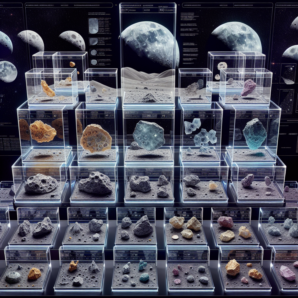
The Potential Future Trends in Lunar Sample Curation
NASA’s Astromaterials Research and Exploration Science Division (ARES) is responsible for curating the largest collection of extraterrestrial materials on Earth, including Apollo-era Moon rocks and microscopic cosmic dust particles. As the Artemis campaign sample curation lead, Dr. Juliane Gross is at the forefront of the efforts to add lunar samples from the Moon’s South Pole region to the collection. In this article, we will analyze the key points from the text and explore the potential future trends in lunar sample curation.
1. Importance of Lunar Sample Return
Lunar sample return missions play a crucial role in advancing our understanding of the Moon and its relationship with Earth. These samples provide scientists with valuable information about the Moon’s geology, history, and potential resources. By studying lunar samples, researchers can unravel the mysteries of the Moon’s formation, its impact on Earth, and its potential for future human exploration and colonization.
2. Collaboration between Different Teams
Dr. Juliane Gross emphasizes the importance of effective communication and collaboration between scientists, engineers, and program managers. The success of sample return missions depends on the coordination and integration of various teams responsible for different stages of the mission, including sample collection, handling, transport, and storage. As future lunar missions become more complex and involve multiple international partners, collaboration will be essential to ensure the safe and efficient return of lunar samples.
3. Advances in Sample Handling and Examination
Dr. Gross acknowledges that technology evolves, and our level of sophistication for handling and examining samples continually improves. As new technologies and analytical techniques emerge, future sample curation will benefit from enhanced capabilities in studying and analyzing lunar materials. These advancements may include non-destructive imaging techniques, isotopic analysis, and high-resolution microscopy, among others. Such innovations will enable scientists to extract even more valuable information from lunar samples and deepen our understanding of the Moon.
4. International Collaboration and Access to Samples
The Artemis sample return missions will offer opportunities for international collaboration in lunar research. After the preliminary examination of the returned samples, the ARES curation team will release a sample catalog, allowing scientists from around the world to request loans for their respective research. This global access to lunar samples will facilitate scientific collaboration and enable researchers to conduct a wide range of studies, from understanding lunar geology to investigating the potential for future human activities on the Moon.
5. The Role of Sample Repositories
Repositories like ARES play a crucial role in curating and preserving lunar samples for future generations. These samples represent priceless scientific assets, and their careful preservation is essential for ongoing and future research. Sample repositories will continue to evolve to meet the demands of sample curation, including the development of advanced storage and protection techniques. Additionally, the accessibility of lunar samples through online databases and virtual sample sharing platforms may improve, allowing researchers worldwide to access data without physical loan requests.
Predictions and Recommendations
Prediction 1: Increasing International Collaboration
In the future, we can expect a growing number of international collaborations in lunar sample curation and research. As more countries and organizations join lunar exploration initiatives, such as Artemis, the sharing of samples and scientific expertise will strengthen global efforts to unravel the mysteries of the Moon.
Prediction 2: Technological Advancements
The development of new technologies in sample handling and analysis will revolutionize lunar sample research. Advanced imaging methods, robotic sample manipulation, and remote sensing techniques may allow for more efficient and detailed examination of lunar materials, providing scientists with unprecedented insights into the Moon’s composition and history.
Prediction 3: Expansion of Sample Repositories
With the anticipated increase in lunar sample returns, sample repositories will likely expand their capabilities and storage capacities. The implementation of state-of-the-art facilities, such as climate-controlled environments and advanced contamination control systems, will ensure the long-term preservation and accessibility of lunar samples for generations to come.
Recommendation: Public Outreach and Education
As the interest in lunar exploration grows, it is crucial to engage and educate the public about the importance of lunar sample curation and research. Outreach programs, public exhibitions, and educational initiatives can help inspire future generations of scientists and foster appreciation for the scientific value of lunar samples.
Recommendation: Collaboration between Scientific Disciplines
Given the diverse nature of lunar sample research, multidisciplinary collaboration will be crucial in addressing complex scientific questions. Encouraging collaboration between geologists, planetary scientists, chemists, biologists, and engineers will facilitate comprehensive and integrated studies of lunar samples, leading to a deeper understanding of the Moon and its significance for future exploration.
Conclusion
The future of lunar sample curation is promising, with advancements in technology, international collaboration, and the expansion of sample repositories. These developments will enable scientists to extract unprecedented information from lunar samples, enhancing our understanding of the Moon, Earth’s history, and the potential for future space exploration. As we embark on the Artemis campaign, Dr. Juliane Gross and her team’s dedication to the preservation and research of lunar samples will contribute significantly to the progress of lunar science.
References:
- NASA – The Importance of Artemis Lunar Samples
- NASA ARES Blog
- NASA – Juliane Gross Bio
by jsendak | Mar 12, 2025 | Computer Science
arXiv:2503.07911v1 Announce Type: new
Abstract: Pixel-level segmentation is essential in remote sensing, where foundational vision models like CLIP and Segment Anything Model(SAM) have demonstrated significant capabilities in zero-shot segmentation tasks. Despite their advances, challenges specific to remote sensing remain substantial. Firstly, The SAM without clear prompt constraints, often generates redundant masks, and making post-processing more complex. Secondly, the CLIP model, mainly designed for global feature alignment in foundational models, often overlooks local objects crucial to remote sensing. This oversight leads to inaccurate recognition or misplaced focus in multi-target remote sensing imagery. Thirdly, both models have not been pre-trained on multi-scale aerial views, increasing the likelihood of detection failures. To tackle these challenges, we introduce the innovative VTPSeg pipeline, utilizing the strengths of Grounding DINO, CLIP, and SAM for enhanced open-vocabulary image segmentation. The Grounding DINO+(GD+) module generates initial candidate bounding boxes, while the CLIP Filter++(CLIP++) module uses a combination of visual and textual prompts to refine and filter out irrelevant object bounding boxes, ensuring that only pertinent objects are considered. Subsequently, these refined bounding boxes serve as specific prompts for the FastSAM model, which executes precise segmentation. Our VTPSeg is validated by experimental and ablation study results on five popular remote sensing image segmentation datasets.
Pixal-Level Segmentation in Remote Sensing: Enhanced Open-Vocabulary Image Segmentation
The field of remote sensing holds great potential for various applications, such as environmental monitoring, urban planning, and infrastructure management. However, extracting accurate and detailed information from remote sensing imagery remains a challenge. Pixal-level segmentation, which involves classifying each pixel in an image into specific objects or classes, is a crucial task in remote sensing.
In recent years, vision models like CLIP (Contrastive Language–Image Pretraining) and Segment Anything Model (SAM) have shown promising results in zero-shot segmentation tasks. These models leverage large-scale pretraining on diverse visual and textual data to learn powerful representations. However, when it comes to remote sensing, specific challenges need to be addressed to improve the accuracy and efficiency of segmentation.
Challenge 1: Redundant masks and post-processing complexity
The SAM model, although effective, often generates redundant masks due to the lack of clear prompt constraints. This means that multiple masks may be produced for a single object, making post-processing more complex. Finding a way to generate concise and accurate masks is vital for efficient segmentation in remote sensing imagery.
Challenge 2: Overlooking local objects
The CLIP model, originally designed for global feature alignment in foundational models, tends to overlook local objects that are crucial in remote sensing. This oversight can lead to inaccurate recognition or misplaced focus in multi-target remote sensing imagery. Addressing this issue is necessary to ensure that all relevant objects are properly identified and segmented.
Challenge 3: Lack of pre-training on multi-scale aerial views
Both the CLIP and SAM models have not been pretrained on multi-scale aerial views, which are common in remote sensing. This limitation increases the likelihood of detection failures, as the models may struggle to accurately segment objects at different scales. Incorporating pre-training on multi-scale aerial views is essential to enhance the robustness and effectiveness of segmentation models in remote sensing.
The Innovative VTPSeg Pipeline
To overcome these challenges, the researchers propose a novel pipeline called VTPSeg (Vision-Text Pretraining for Segmentation). VTPSeg combines the strengths of multiple models, namely Grounding DINO (GD+), CLIP Filter++ (CLIP++), and FastSAM, to achieve enhanced open-vocabulary image segmentation.
- The Grounding DINO+(GD+) module is responsible for generating initial candidate bounding boxes. This module leverages the power of pre-training on diverse visual and textual data to identify potential objects in remote sensing imagery.
- The CLIP Filter++(CLIP++) module uses a combination of visual and textual prompts to refine and filter out irrelevant object bounding boxes. By incorporating both visual and textual cues, CLIP++ ensures that only pertinent objects are considered for further segmentation.
- Finally, the refined bounding boxes serve as specific prompts for the FastSAM model, which executes precise segmentation. FastSAM takes into account the local objects often overlooked by CLIP, resulting in more accurate and detailed segmentation in multi-target remote sensing imagery.
Impact and Future Directions
The VTPSeg pipeline offers a significant advancement in pixel-level segmentation for remote sensing. By addressing the challenges specific to this field, the pipeline holds promise for improving the efficiency and accuracy of object segmentation in remote sensing imagery.
The multi-disciplinary nature of VTPSeg is noteworthy. It combines techniques from computer vision (CLIP and FastSAM) with language understanding (CLIP) and pre-training methodologies (Grounding DINO). This integration of diverse disciplines enhances the capabilities of the pipeline and opens up opportunities for cross-pollination of ideas between different fields.
Furthermore, the concept of enhanced open-vocabulary image segmentation, as demonstrated by VTPSeg, aligns with the wider field of multimedia information systems. Multimedia information systems deal with the management, retrieval, and analysis of multimedia data, including images and videos. Accurate segmentation is vital for efficient indexing and retrieval of multimedia content, making VTPSeg relevant not only for remote sensing but also for various multimedia applications.
Looking ahead, future research can explore the application of VTPSeg to other domains beyond remote sensing. The pipeline’s modular design allows for potential adaptability to different types of images and datasets. Additionally, incorporating more sophisticated techniques for post-processing and refinement of segmentation results could further improve the accuracy and usability of VTPSeg.
In conclusion, the VTPSeg pipeline presents a promising approach to enhance open-vocabulary image segmentation in remote sensing. By leveraging the strengths of different models and addressing the specific challenges of this field, VTPSeg contributes to the wider field of multimedia information systems and paves the way for future advancements in object recognition and segmentation.
Read the original article